Seashore
1 of 30Blackwater
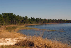
2 of 30Eglin
3 of 30Econfina
4 of 30Apalachicola
5 of 30Chipola
6 of 30Nokuse & Pine Log
7 of 30Ocala National Forest
8 of 30Rice Creek
Etoniah
Gold Head
9 of 30Camp Blanding
10 of 30Lake Butler Forest
11 of 30Osceola National Forest
12 of 30Suwannee River
13 of 30Kissimmee River
14 of 30KICCO
15 of 30Three Lakes
Bull Creek
16 of 30Tosohatchee
17 of 30Lake Jesup
18 of 30Upper Kissimmee
19 of 30Cassia
20 of 30Reedy Creek
21 of 30Croom
22 of 30Green Swamp
23 of 30Citrus
24 of 30Cross Florida Greenway
25 of 30Big Bend
Aucilla
26 of 30Big Cypress
27 of 30Seminole
28 of 30Okeechobee
29 of 30Byrd Hammock
30 of 30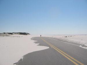 Length: 25.3 miles (linear)
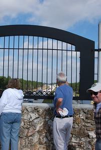
The Gulf Islands National Seashore is the northern terminus of the Florida Trail and home to the only National Scenic Trail beach hike in the nation. Get immersed in colonial history at the trailhead at historic Fort Pickens. Take in the sights of our Florida Trail Gateway Community in Pensacola Beach. Travel through the unique ecological environment of pine trees, yucca plants, sea oats and dunes while seeing the many raccoon tracks and osprey nests and searching for the elusive Santa Rosa Island Beach Mouse. Or, simply enjoy a walk along the beach through sparkling white quartz sand beside the beautiful emerald waters of the Gulf of Mexico. A backcountry campsite is located along the Dunes Trail area facing Santa Rosa Sound.
For more information contact the Western Gate Chapter
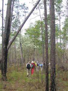
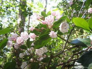
Blackwater River State Forest: Heading north from Yellow River Ravines, hikers enter one of the largest state forests in Florida named after the Blackwater River. Trails maintained by the Chapter include the Hutton Unit, Juniper Creek, Jackson, and Wiregrass. The Juniper Creek Trail provides access to Blackwater River State Park, while the Jackson Trail provides access to recreation areas at Bear, Krul, Karick, and Hurricane Lakes and links to the Wiregrass Trail, which continues north to the Florida/Alabama state line. The state forest is home to a longleaf pine/wiregrass ecosystem. Blackwater River and Juniper Creek, with their white sandy beaches and river bluffs, are accessible at many spots along the trails. Other special features include pitcher plant bogs, blueberries, mountain laurel, rhododendron, and wild azalea. Wildflowers can be found blooming at many spots along the trail in the spring and fall.
For more information contact the Western Gate Chapter
 Length: 34 miles
North bound thru-hikers, traveling west through the panhandle will pass through Holt along US 90 and proceed south on Log Lake Road. They can then head south and west, through the Yellow River Ravines and Weaver Creek Sections, to the northern terminus of the FNST in the Gulf Islands National Seashore or, upon reaching Deer Lake Junction, proceed north on the official FNST side trail to the Florida/Alabama state line.
Yellow River Ravines Section
This section, which runs in a mostly northeast/southwest direction between Log Lake Road and State Road 87, passes through a variety of terrain along the north side of the Yellow River. Near the northeast end, a camping opportunity is available near Guest Lake Park. Reaching Deer Lake Junction, hikers may choose to head to Ft. Pickens in Gulf Islands National Seashore on the main trail, with the Wild Azalea backcountry campsite along this route. There is, currently, a six-mile road walk on the western end of this section that connects with the Weaver Creek Section. New trail is currently under construction to replace the road walk. Hikers choosing to head north from Deer Lake Junction toward Alabama on the blue-blazed side trail, can camp at Burnt Grocery Creek backcountry campsite.
Weaver Creek Section
Weaver Creek Trail is located on the western edge of Eglin Air Force Base (AFB), stretching approximately 14 miles between Navarre and the Yellow River. Hikers meander through upland pines and oaks, cross a beautiful spring-fed stream and pass through a large, picturesque steephead. Other points of interest include enjoying the shady coolness of titi swamps, crossing lichen-covered hillsides, and two backcountry campsites: Dean Campsite in the south and Buck Pond in the north. Since this trail is located on Eglin AFB, recreational and camping permits are required (contact Eglin AFB -Jackson Guard at 850-882-4165 or go to https://eglin.isportsman.net for permit purchases).
 Length: 32.9 miles (linear)
FTA Volunteers call the Florida Trail on Eglin the land of “was that thunder?”. Hiking is on an active military reservation. Of special interest is Eglin’s role as a weapons development and testing facility. The rumbles in the distance are rarely thunder.
From the trailhead on SR 285 you hike southwest and quickly drop into Gum Creek drainage. The route parallels Gum but the creek is rarely seen until you cross it just shy of 2 miles. Just before reaching Gum, the Speck Pond Spur Trail (campsite) connects from the south. From Gum Creek the trail begins an up and down pattern for the next 6 miles. The first major stream is Big Fork Creek. The floodplain west of the bridge is often flooded after heavy rains and during periods of high water. Hikers should exercise extreme caution. Do not attempt the crossing if conditions are dangerous.Not far past Big Fork the trail starts to parallel Titi Creek. Titi is the major drainage creek in the section. The trail crosses Titi on an old wooden road bridge. A half-mile ahead you pass Jr Walton Pond (campsite). Moving west the trail crosses three major creeks – Honey, Silver and Pearl. Each of the creeks is different. Honey is cut deep with the bridge high above the water. Silver is open, wide and inviting. You can sit on the bridge and soak your feet. Pearl is lined with Atlantic white cedars. The trees form a canopy keeping Pearl shaded and cooler than the surrounding forest. Just before reaching Pearl Creek you come to Pearl Backcountry Campsite.On this portion of Eglin there is one backcountry campsite (Pearl – not vehicle accessible) and two vehicle accessible campsites (Speck Pond and Jr. Walton Pond). For more information contact the Choctawhatchee Chapter
 Length: 38.6 miles (linear)
FTA Volunteers call the FNST on Eglin the land of “was that thunder?”. In 1908 this area was part of the Choctawhatchee National Forest and converted to a military reservation in 1940. In addition to the Air Force base both the Army and Navy heavily utilize the reservation for training. Of special interest is Eglin’s role as a weapons development and testing facility. The rumbles in the distance are rarely thunder!
In spring there are wildflowers all along the trail with an abundant display of mountain laurel and flame azalea in the Alaqua Basin. In the fall the wildflower display shifts to the sand ridges where the yellows explode in late October. There are numerous stream crossings. All are bridged with the exception of the eastern crossing of Alaqua Creek. There are 4 backcountry campsites spaced 7-10 miles apart. All campsites have fire rings and are located close to flowing streams that originate within Eglin. None of these campsites are accessible via vehicle. DeFuniak Springs is a Victorian town on the National Register of Historic Districts. Motels, restaurants and groceries are available at the I-10/US 331 intersection. For more information contact the Choctawhatchee Chapter
 Length: 19.6 miles (linear)
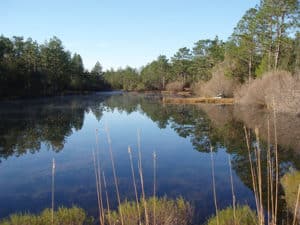
Nokuse Plantation consists of a rich compilation of upland, wetland and freshwater communities. These communities provide habitat for a myriad of plants and animals, including threatened and endangered species.
The Pine Log Trail was the Panhandle Chapter’s first trail. It was built in the mid 1980s shortly after the chapter’s formation in 1982. Most of this lovely 8-mile length of Florida National Scenic Trail
passes through Pine Log State Forest. This State Forest, the oldest in the State, is managed by the Florida Forestry Service.
The western end of the Pine Log Trail is located where Strickland Rd meets SR 20 on the west side of SR 79. The eastern end is located where the trail meets SR 20 once again, on the east side of SR 79. The trail passes (west to east) by four beautiful cypress ponds within the Sand Pond Recreation Area, crosses under SR 79 and parallels Pine Log Creek for a few hundred yards, follows the site of the 1820’s historic Military Road for a short distance, passes through stately pine flatwoods, and leads hikers through the dark and mysterious Luke’s Trail. The Pine Log Trail passes within about a half mile of the small town of Ebro, where through hikers can find a motel, convenience store, and sandwich shop.
Econfina Trail in Econfina Section – 18 miles
The 18 miles of Florida National Scenic Trail in the Econfina Section are viewed by many hikers as some of the most beautiful in the entire State of Florida. The Econfina Trail passes through public property managed by the Northwest Florida Water Management District. This popular trail leads hikers through rugged ravines and tunnels of mountain laurel and wild azalea, for an experience similar to a walk in the foothills of the Appalachian mountains, especially in spring when the flowers are in bloom. Much of the trail follows Econfina Creek through wooded areas of lush vegetation. The trail passes by a lovely 10-foot waterfall, and crosses many bridges, including two impressive 60-ft suspension bridges called Fender and Two Penny. Primary trail access points are the Scott Rd Trailhead off US 231 north of Fountain, and the SR 20 Trailhead near Pitt Spring on SR 20 between SR 77 and US 231. Another access point is Walsingham Bridge, accessible via Strickland Rd near Pitt Spring on SR 20. For more information contact the Panhandle Chapter
 Length: 36.9 miles (linear)
Most of this section of trail is a public-spirited effort of the Foley Land and Timber Company in cooperation with the Florida Trail Association. The forestry practices are visible along the trail. The Econfina River flows diagonally across the section. Deer, turkey, and other wildlife may be observed on occasion. Private hunt clubs lease the land for hunting.
South of the trail, the city of Perry (crossroads of US 98, US 27, and US 221) is the home of the Forest Capital Museum State Park, which commemorates Florida’s long history as a timber-producing state. In late October, the Florida forestry industry celebrates its good fortunes with the gala Florida Forestry Festival. A parade, a giant fish fry, an awards banquet, and a crafts exposition attract nearly 50,000 people to this Big Bend city’s festival every year. Hikers are welcome to attend. For more information contact the Suwannee Chapter
 Length: 48.8 miles (linear)
This part of the trail is excellent for short day hikes and loops. It crosses through several vegetation types, including sandhills, pine flatwoods, bottomland hardwoods and transition zones to salt marshes. On the eastern end the trail passes through one of the largest untouched cabbage palm hammocks remaining in Florida. This area is known locally as “The Cathedral” for the solitude and stately nature of the tall palms.
To the east and south of US 319, the trail crosses public lands in the St. Marks National Wildlife Refuge. Most of the hiking is dry except during periods of heavy rain. Permits are required for overnight camping. At Marsh Point, a blue-blazed spur trail heads out across the salt marshes to the remains of old Confederate salt works. Look for islands of red cedar trees to spot the salt works.
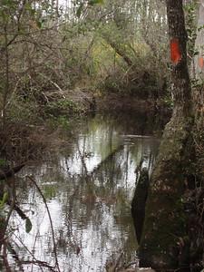
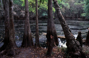
North of the refuge, you enter the Apalachicola National Forest. The Sopchoppy River portion of the trail follows the high and occasionally rocky banks of a Blackwater River. Pine-palmetto flatwoods with titi (pronounced TIE-tie) are common up to the river’s edge. In the central section, the trail turns away from the river and crosses a large clear-cut surrounding Monkey Creek. The southern section is notable for a gurgling tributary stream with several small waterfalls and for large cypress trees growing beneath steep river banks. The trail in the eastern part of this 557,000 acre forest passes through a unique natural feature called Bradwell Bay. The term “bay” refers to a broad stretch of low land between hills. Bradwell Bay is a huge, shallow saucer containing a vast stretch of titi thicket (buckwheat tree) in the center, with occasional clusters of blackgum and other hardwoods, surrounded by higher ground with typical pine and palmetto sandy terrain. Bradwell Bay was named for a hunter who was lost for days in the vast, trackless titi thicket. Forests along the trail contrast with the bays and have a large variety of plants and animals typical of pine and palmetto forests.
In the Bradwell Bay Wilderness, the trail passes for a short distance through an undisturbed and uncut swamp containing trees up to 400 years old. The rest of the trail in the wilderness traverses titi and second growth forests which are a haven for bears, red cockaded woodpeckers and pitcher plants. This is a wet and rough trail and is therefore not recommended for first time hikers. If the ditches along Forest Roads 329 and 314 are dry, then the hike is likely to be a pleasant one, with only short areas of wading. The big trees of most interest in the wilderness area are on the western part of this trail, between Forest Road 314 and Monkey Creek.
After passing a pioneer homestead and following the floodplain of the Ocklochnee River, this segment of trail ends just west of the river at the Porter Lake Campground. For more information contact the Apalachee Chapter
 Length: 34.9 miles (linear)
The Trail crosses the Apalachicola District of the National Forest in Florida and meanders through and around many large pine palmetto flatwoods separated by titi (pronounced TIE-tie) and cypress swamps. This segment of trail is one of the most remote in Florida and offers a wide variety of flora and fauna year-round. Animals of the forest include red-cockaded woodpeckers, osprey, bald eagles, sandhill cranes, turkeys, alligators, bears, and panthers.
The west end of the trail traverses an interesting low savanna profuse with ground orchids and spring wildflowers. Midway along the trail are the remnants of the settlement of Vilas, a reminder of the turpentine industry. There is good fishing on the Ochlockonee River and in Camel Lake, along with plenty of additional opportunities to fish in the creeks and water holes along the way.
To the west of Porter Lake Campground, the dominant vegetation is longleaf and slashpines with an under story of palmetto and wiregrass. A few turkey oaks occur in areas where there is better drainage. Vegetation along the drainages includes titi, tulip poplar, and other hardwoods. The trail crosses Coxes Branch on a suspension bridge. Summer wildflowers such as meadow beauty can be seen in this area. Wading can be expected if recent rainfall has been heavy.
Hikers in the northwestern corner of the Apalachicola National Forest near Camel Lake can explore a diverse area of unique plant communities. Between Memery Island and County Road 12, the trail passes through an area of pitcher plant savannas and hardwoods along drainages. East of Forest Road 108, the trail descends into pine flatwoods with a short section across a pitcher plant savanna and through a cypress swamp. A 9.4 mile loop is possible by parking at Camel Lake and hiking to Memery Island, Sheep Island, and Bonnet Pond before returning to Camel Lake. Numerous shorter day hikes are possible by checking the map for access points where the trail crosses sand roads. For more information contact the Apalachee Chapter.
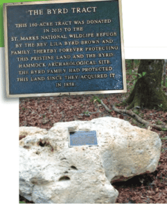 Byrd Hammock is a rare, double ring midden site located within the St Marks Refuge of Northwest Florida. A ring midden is a circle of prehistoric trash left behind by past peoples living in a ring-shaped village facing a central, open area or plaza. The southern half of the site (Byrd Hammock South), dating between 400-650 AD, is associated with the Swift Creek culture. The northern half of the site (Byrd Hammock North), dating between 650-850 AD, is associated with the Weeden Island culture. Byrd Hammock is significant because it contains two separate ring middens (Byrd Hammock North and Byrd Hammock South) located right next to each other. These two ring middens represent a critical moment in American Southeastern archaeology when ideology, beliefs, and material culture shifted from Swift Creek to Weeden Island, all at one location.
 Length: 71 miles (linear) from Big Shoals State Park to Winquepin St.
This is the only segment of the Florida Trail which runs almost continuously beside a major river. The terrain varies from hardwood hammocks, high sandhills, and limestone rock bluffs to swamps and flat dirt roads. The trail crosses many small streams, up and down steep ravines, and several swamps. At times of high water these sections can be very wet or unpassable. This section of trail is managed by the Suwannee River Water Management District, Stephen Foster State Park, Suwannee River State Park, and Twin Rivers State Forest.
The Suwannee River has tannin rich tea-colored water, stained by cypress trees and oak leaves. It is fed by springs, which are seen as clear blue water where they enter the river. Striking white sand beaches occur on river bends, providing perfect places to camp or swim.
Along the trail, you’ll see clusters of huge cypress and oak trees in the middle of primitive swamps. White lilies, wild azalea, sparkleberries, dogwood and redbud grow along the path, as do giant tupelo trees. At the western end, there is an abundance of spruce pine growing around rugged surface limestone punctuated by sinkholes. Many types of animals including otter, beaver and water birds may be seen. In the fall, a muted color change in the leaves is a reminder of autumn’s touch. Devil’s Mountain, a picturesque bluff over 130 feet above the water, is named after the Devil’s walking stick, a strange barbed shrub which grows there.
This section of trail is especially notable for its rugged terrain and geologic features. Take the blue-blazed side trail to Disappearing Creek to watch a creek swallowed whole by a sinkhole; pause and look out over a whirlpool in the river; watch the water tumble down the rock hillside at the Mill Creek waterfall; walk along the edge of Holton Spring. The Holton Creek Tract is home to the second largest bald cypress tree in the world as well as the world’s tallest live oak tree. For more information contact the Suwannee Chapter and the Sandhill Chapter of the FTA.
Once the trail leaves Suwanee River State Park it enters the Twin Rivers State Forest. They lands here are owned by the Suwannee River Water Management District. It is managed by two state agencies; Florida Division of Forestry (primary) and the Florida Game and Fresh Water Fish Commission (hunting).
There are four primitive campsites along the trail. Two are within the Ellaville Unit, and the Black and Mill Creek North Units each have one. Other points of interest along the trail include the Big Oak Trail, a loop trail on the peninsula formed by the confluence of the Suwannee and Withlacoochee Rivers, the Stroud Family Cemetery, and the Drew Mansion Ruins. To reach this historic site and picnic area, follow the blue-blazed trail just south of the railroad tracks close to old US 90 (0.5 mile round trip). It was at this point that historians believe Spanish explorer Hernando DeSoto crossed the Suwannee River in September 1539 on his quest to the Mississippi River. The picnic area is also the site of the Drew Mansion Ruins, once the plantation home of Governor Drew during the post-Civil War Reconstruction period. A blue blazed interpretive trail leads you around the historic site. From the picnic area, the Big Oak Trail leads east across the river into the main part of the park.
To the west of CR 53, the Florida Trail follows forest roads owned and managed by private timber companies. This is a spirited effort of the companies in cooperation with the Florida Trail Association. Hikers have the opportunity to witness ongoing commercial forestry activities. The companies also lease out the hunting rights to their lands. For more information contact the Suwannee Chapter.
 Length: 24.2 miles (linear) from the Olustee Battlefield to Cow Catcher Rd.
The Osceola National Forest is Florida’s smallest national forest, but it encompasses prime habitat for the Florida black bear and the endangered red-cockaded woodpecker, which thrives only in old-growth longleaf pine forests. Established in the 1930s, it remains a patchwork of inaccessible swamps, pine plantations, and natural forests of longleaf pine.
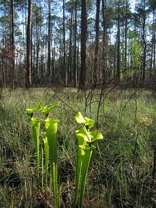
Start your hike at Florida’s most significant Civil War historic site, the Olustee Battlefield. From here, the first mile of trail – dubbed the Nice Wander Trail – provides a surface suitable for the disabled to enjoy the outdoors, passing through a red-cockaded woodpecker colony. Then it’s into the forests, miles and miles of immersion in the pines broken up by boardwalks over bayheads and along seepage slopes where hooded pitcher plants thrive. Old forest roads are utilized in some places to connect segments of footpath. Watch blazing carefully. An open-sided shelter provides a peaceful campsite for backpackers. Expect a lot of wading after a heavy rain, as the footpath tends to collect water.
Leaving the protection of the Osceola National Forest, the Florida Trail becomes a short roadwalk on quiet back roads as it makes its way to the Suwannee River at Big Shoals State Park. Once along the Suwannee, you’ll enjoy the heavy shade of the hardwood hammocks as the trail traverses extremely rugged terrain, dropping in and out of many deep ravines along the river bluffs. Stream crossings range from walking across planks and logs to hopping over narrows. Marvel at the beauty of Big Shoals and Little Shoals, Florida’s roughest whitewater.
After passing under US 41, the trail continues into White Springs, a historic and popular trail town and resupply stop and our first Florida Trail Gateway Community. If you are doing a long distance hike, stop in at American Canoe Adventures on Bridge Street to get your photo taken for the thru-hiker wall! For more information contact the North Florida Trailblazers.

Length: 23 miles (linear) from the City of Lake Butler to Olustee Battlefield
The section is along rural roads through the small city of Lake Butler and within the Lake Butler Forest which is operated as a tree farm by Weyerhaeuser. Although the great majority of the forest is planted pines, a few hardwood areas remain.
At any given time, a large part of the trail will pass through or along the edge of clear-cuts. Between new seedling planting and their maturation, these areas are typified by high grasses and panoramic vistas. Sightings of deer and turkey are fairly common. The trail from the Lake Butler Forest connects to the Osceola Experimental Forest before making its way into the Osceola National Forest. Pay close attention to turns, and carry a map with road numbers, as the trail follows several different roads.
If you are hiking through Olustee or on Osceola National Forest trails during the middle of February, be on the lookout for enemy scouts, infantry, and artillery! You may detect the characteristic odor of gunpowder if the wind is right. The annual reenactment of the Civil War Battle of Olustee fought near Ocean Pond on February 20, 1864 occurs near the Battlefield Museum on US 90, east of the town of Olustee. Everyone is invited, but don’t wear a Civil War cap unless you are ready to do combat with the other side! For more information contact the North Florida Trailblazers.
 Length: 35.9 (linear) from SR 21 to City of Lake Butler
The trail through Camp Blanding takes you through undulating sandhill terrain, with some spectacular scenic views from the hilltops. If it’s a clear day, the distant rumble is not thunder, but bombing exercises. You’ll walk through the hilly sandhill terrain, with its forests of longleaf pine and turkey oak, densely forested areas with different kinds of hardwood trees and shrubs, and pine plantations in various growth stages. Scattered patches of scrub habitat, with brilliant white sand and plants that can survive extreme heat and dryness, introduce you to Florida’s “desert.” Wildlife includes pocket gophers, gray foxes, and squirrels. In the pine woods along the trail, look for “catfaces” (the scars on pine trees left by the turpentine industry) and for red-clay turpentine pots which look like flower pots. Pause and enjoy a cool breeze at the many lakes along the way including a beautiful circumnavigation of Magnolia Lake. The trail passes through the historic, and now defunct, Magnolia Lake State Park. A troubling reminder of the past, the State Park was one of Florida’s segregated state parks from 1957 until the late 1970s.
After leaving Camp Blanding the trail stays on the Palatka Lake Butler State Trail which is a multi-use rail trail. It is both paved and unpaved and heads towards the city of Keystone, a great place to resupply. The rail trail officially ends in Lake Butler.
NOTICE
For more information contact the North Florida Trailblazers
") Length: 34.3 miles (linear) from SR 20 to SR 21
Length: 34.3 miles (linear) from SR 20 to SR 21
Continuing through the rolling sandhills of Florida’s Central Highlands, the Florida Trail traverses longleaf pine forests (some natural, most planted for harvesting) owned by timber companies. Dropping down along Rice Creek, the trail follows a floodplain where ancient cypresses stand sentinel over the remains of a Revolutionary War-era indigo and rice plantation. Using unpaved roads to connect protected sections, the trail swings west into Etoniah Creek State Forest, where it parallels a ravine more than forty feet deep.
Watch for the trees of Appalachia to make their first appearance along this segment—tulip poplars, dogwoods, and sassafras, as well as fragrant azaleas in spring. West of the ravine, you encounter a pleasant camping shelter at Iron Bridge, and look down from another bluff across a winding creek before working your way through dense oak forests to reach the Holloway Road trailhead. To minimize your impact to the feeder streams and marshes through this area, here are many bridges and boardwalks, and they can become slippery when wet.
A road walk presently connects the Tinsley Road trailhead at Etoniah Creek State Forest with the south gate of Gold Head Branch State Park. Inside the park, enjoy more than three miles of scenic hiking. After you pass through the cabins and picnic area along Little Lake Johnson, the trail follows Gold Head Branch upstream along the shady ravine, and emerges in a sandhill area to circle around the eerie Devil’s Washbasin before exiting the park. For more information contact the North Florida Trailblazers.
 Length: 50.7 miles (linear) from SR 40 to SR 20
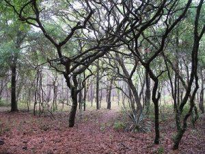
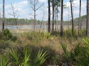
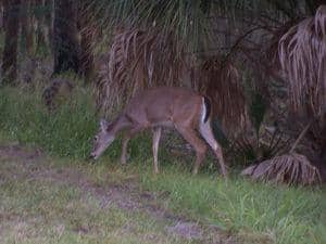
The northern part of the Ocala National Forest nurtures upland habitats of rolling sandhills topped with longleaf pines and oaks. Wiregrass thrives, carpeting the forest floor in a misty haze that turns to lilac in winter. These forests are relatively open, an important habitat for wildlife like deer, fox squirrels, and red-cockaded woodpeckers. There are also extensive stands of shortleaf or sand pine along the trail. Look for scrub jays in this habitat. Wildlife common to both habitats are eastern diamondback rattlesnakes, indigo snakes, corn snakes, armadillos, raccoon, deer, gopher tortoises, and black bears. Observe, enjoy, and respect all wildlife, leaving them as you found them.
Surface water is found only in scattered flatwoods ponds. As you approach Rodman Reservoir and the Ocklawaha River floodplain, the trail passes through floodplain forests, and may be knee-deep in water if the rivers are high. The footpath is well maintained and well worn, and signage at road crossings helps you figure out exactly where you are. Although there are a number of designated campsites along this segment, you may camp anywhere you wish—as long as it’s not hunting season. Be aware of when hunting seasons occur, and make sure you wear blaze orange.
At the extreme northern end the trail reaches Rodman Reservoir and follows the Cross Florida Greenway through Rodman Campground along the banks of the Cross Florida Barge Canal. Look for manatees swimming in the canal! This section of trail is maintained by the Black Bear Chapter.
 Length: 28.2 (linear) from Clearwater Lake to SR 40
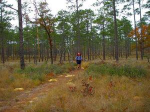
Welcome to the Ocala National Forest, the heart and soul of the Florida Trail. In October 1966, Florida Trail Association founder Jim Kern and a handful of hardy hikers painted the trail’s first blaze at the beginning of this segment at Clearwater Lake. Offering a week’s worth of unbroken wilderness hiking through sandhills, prairies, pine flatwoods, and the beautiful Big Scrub, this is the prime destination for backpackers who want to spend a week out on the Florida Trail. The footpath is well maintained and well worn, and signage at road crossings helps you figure out exactly where you are.
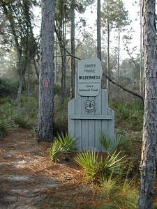
Although there are a number of designated campsites, you may camp anywhere you wish—as long as it’s not hunting season. The Ocala National Forest draws a lot of deer and turkey hunters, so be cognizant of hunting season, when you must stay at designated campsites. Always wear blaze orange during hunting season. This segment of the trail offers numerous don’t-miss stops, from the swimming holes at Alexander and Juniper Springs to to stunning prairies at Farles and Hopkins. You’ll walk through hydric hammocks crowded with palms, through open prairies filled with wildflowers, and through the wild and wonderful Juniper Prairie Wilderness with its many pristine ponds. The north end of this segment is at Hopkins Prairie, a vast open wetland which the trail winds along for miles (occasionally in the shade) of the oak forest on its shoreline.
A side trip on the blue-blazed trail to beautiful, crystal clear Alexander Springs (78 million gallons per day) is highly recommended for those who would like to stop for a snack or swim in the cool spring water. Portions of the forest near Alexander Springs, Billies Bay and Juniper Prairie are designated wilderness areas. Trail work in the Juniper Prairie Wilderness must be done with hand tools only and FTA workers use two-person crosscut saws to remove blown down trees on this section of the trail. Juniper Springs is also good for swimming, and the Juniper Springs Run is a great short canoe trip. Canoe rental and canoe shuttle service are available at the park concession. This section of trail is maintained by the Black Bear Chapter north of Hwy 40 and Highlanders Chapter South of Hwy 40
 Length: 32.2 miles (linear) from Baseline Trailhead to The 88 Store
East of the Baseline Trailhead, the FT the trail changes dramatically as you enter Marshall Swamp, following a crunchy gravel footpath through this jungle-like hydric hammock floodplain of the Silver River. This short section of trail is loaded with enormous trees. Emerging at the Marshall Swamp trailhead, the trail enters the southeastern corner of Silver Springs State Park then follows a connecting roadwalk north on CR 314, crossing an old drawbridge over the Ocklawaha River at historic Sharpes Ferry.
After the road walk on CR 314 the trail enters the Ocala National Forest for the first time on the Western Corridor. The next 20 miles of trail travel through a mixture of hardwood hammock, pine flatwoods, sandhill, and swamp. The junction of the east and west corridors is just south of CR 316 right behind the famous 88 Store and Pub, a popular destination for thru hikers.
 Length: 40.6 miles (linear) from Inverness to Baseline Trailhead
In this segment, the Florida Trail follows a roadwalk through the historic town of Dunnellon (founded during the 1890 phosphate boom) before enjoying the protection of the Marjorie Harris Carr Cross Florida Greenway, a broad strip of public space more than a century in the making. Numerous developed trailheads make access a breeze for day hiking and longer trips.
From the Pruitt Trailhead, the FT heads in a northeasterly direction, paralleling the north side of the canal route. You’ll face some rugged walking, including a major switchback and several minor ones, as the trail winds along forested mounds of dirt left behind from the canal diggings. There are several opportunities for scenic views across the remains of the canal, both before and after the SR 200 crossing.
 Length: 31.4 miles (linear) from Inverness to Willow St. plus 40.6 mile loop
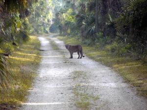
The Citrus Tract of the Withlacoochee State Forest is the smallest of the tracts on this forest, but certainly just as beautiful. For backpackers and day hikers, the four loop trails (A, B, C, and D) in the Citrus Tract of Withlacoochee State Forest are not presently part of the thru-trail but offer some of the finest challenging terrain in Central Florida. The trail climbs up and down rolling sandhills topped with pines and oaks, drops down into deep ravines created by erosion of the limestone bedrock, circles massive sinkholes, where jagged limestone protrudes into the footpath, and passes by the fern-draped openings of numerous caves. Wildlife is abundant: deer sightings are virtually guaranteed, scrub-jays live in the sand pine scrub, and Florida panthers have been spotted here. The sandhills are high and dry, so plan backpacking trips carefully; you may want to cache water at trail crossings. Designated campsites let you get away from it all.
From Inverness the trail heads south through Whispering Pines Park into the State Forest until reaching the road walk at County Road 480. An eight mile road walk leads into the FWC managed Chinsegut Environmental Education Center, Colonel Robins Tract of the WSF, and Perry Oldenberg Wildlife and Environmental Area before making its way towards the Croom Tract of the WSF. Chinsegut is a great place to enjoy a loop hike and birdwatching from the numerous observation decks on the property.
") Length: 20.1 miles (linear) from Willow St. to Ridge Manor plus 20.1 mile loop
Length: 20.1 miles (linear) from Willow St. to Ridge Manor plus 20.1 mile loop
Leaving the Richloam Tract of Withlacoochee State Forest, the trail continues to its westernmost point (less than 20 miles from the Gulf of Mexico) en route to the Croom Tract. Plans are in the works to build a connecting trail between Blue Sink (at the northwestern most point of the Richloam Loop) and the Croom Tract. Meanwhile, hikers must connect the two natural areas via a roadwalk. The Croom Hiking Trail is a gem along the route, anchored by two beautiful developed campsites on either end as it winds through hardwood and floodplain forests along the Withlacoochee River.
After you complete the Croom Hiking Trail, it’s back to a connecting roadwalk to reach the Withlacoochee State Trail, a rail trail that serves as the FT’s temporary route to the north. Backpackers and day hikers have the option of accessing the Croom Loops (A, B, and C) from the Silver Lake Trailhead or the Withlacoochee State Trail off Croom-Rital Road. These loop trails are described by some hikers as “fitting exercise to get in shape for the Appalachian Trail,” as they ascend and descend rolling sandhills topped with pines and oaks. When the river is in its floodplain, don’t miss a 3.5 mile loop day hike by taking the access trail from Silver Lake Recreation Area to the blue-blazed low water trail; it passes through spectacular stands of old-growth cypress trees. Use the orange-blazed high water trail to create a loop back to the trailhead.
 Length: 33.8 miles (linear)
 Length: 29.2 mile (linear)
The Lake Jesup section passes through deep woods and along village streets and roads and follows along the beautiful Econlockhatchee River.
 Length: 34.9 miles (linear)
Tosohatchee presents a diverse hiking experience that includes pine flatwoods, cabbage palm/oak hammocks, and cypress forests. This region has a vast history. From 1930 until 1977, this area was used for the Tosohatchee Gun Club and was left untouched in order to encourage wildlife. The state acquired the Wildlife Management Area in 1977. At least 30 Indian mounds have been discovered.
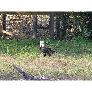
Hikers options in Tosohatchee Wildlife Management Area include taking an overnight hike or selecting one of several day hikes. On the north side of the Area, a trail leads to a virgin bald cypress stand in Jim Creek Swamp. Tosohatchee has a variety of wildlife, including deer, turkey, armadillo, osprey, and eagles. The dikes provide good vantage points.
In the spring, the Management Area is colorful with wildflowers, including wild iris, which blooms in purple profusion in the woods, drainages, and on the edge of the swamp. Orlando Wetlands Park is a large-scale man-made wetland designed to treat reclaimed water and provide wildlife habitat. Deer, raccoon, alligators, turtles and over 150 species of birds have been seen in the park. At least five endangered bird species call the park home. A festival every Spring highlights the wildlife in the region.
") Length: 30 miles (linear) from SR 471 to Ridge Manor plus 25.9 mile loop
Length: 30 miles (linear) from SR 471 to Ridge Manor plus 25.9 mile loop
The Green Swamp offers a variety of plants, animals, and topography. There are mile-wide pastures, extensive riverine swamps, and relict sand dunes supporting longleaf pine, turkey oak, and wiregrass. The trail passes through many large oak hammocks as well as pine flatwoods, palmetto prairies, and cut-over timber lands which are being allowed to regenerate. One segment of trail overlooks the Withlacoochee River and its rapids some twenty feet below. Deer, feral pigs, alligators, fox, bobcat, otter, and armadillos are frequently seen. There are scrub jays, sandhill cranes, marsh hawks, and many types of waterfowl.
Continuing through the vast Green Swamp, the Florida Trail turns north and parallels the Withlacoochee River’s flow towards the Gulf of Mexico, with views from high bluffs. The north end of this segment traverses the Richloam Tract of the Withlacoochee State Forest. Much of the southern extent of Richloam is low-lying cypress swamp along the Withlacoochee, but well-developed pine forests cover the higher elevations, deeply blanketing the trail in a carpet of soft pine needles. The loop trail provides an excellent weekend backpacking outing, and leads through and past some interesting features, including a forest of eucalyptus trees, ancient live oaks, and deep sinkholes. The loop trail can be accessed from several road crossings to take shorter day hikes as well.After periods of heavy rain, you’ll wade through some of the cypress floodplains. In several places, the trail briefly shares forest roads with limited vehicular traffic and equestrians.
 Length: 25.4 miles (linear) plus 9.7 mile loop
Lush hardwood forest, Green Swamp East Unlike most of the swamps along the Florida Trail, the Green Swamp is more dry than wet. Encompassing 870 square miles across five counties, it’s a vast watershed of pine forests and cypress swamps where four of the state’s major rivers (Ocklawaha, Peace, Hillsborough, Withlacoochee) are born, each flowing away in a different direction.
This segment of trail leads you down a rural roadwalk on Deen Still Road past cattle ranches and orange groves; look for unusual sandstone formations along the road. The trail follows the Van Fleet State Trail for several miles before returning to rural roads up to the entrance to the Green Swamp East WMA.
Re-entering the forest, you parallel the northwesterly course of the Withlacoochee River. After periods of heavy rain, you’ll wade through some of the cypress floodplains. In several places, the trail briefly shares forest roads with limited vehicular traffic and equestrians. However, this is a wild and beautiful section of trail with a lot of wildlife. Look for Sherman’s fox squirrels in the sandhills, and deer in the open flatwoods understory. The white-blazed loop trail at the Rock Ridge Road trailhead provides a long day hike or a short overnight backpacking trip.
 Length: 27.9 miles (linear)
Currently this entire section is a road walk until such time as the Florida Trail Association can reroute it to a more natural setting.
Although there is no designated camping along this route, there are motels in several key areas. Once the heart of Central Florida’s cattle country and orange groves, the region encompassed by this segment has changed dramatically since the opening of Disney World. Where a scant decade ago you’d walk through rolling hills topped with orange groves, the landscape is crowded with vacation homes. Still, there are some interesting historical artifacts and preserved lands along the way. The FT also utilizes the Bill Johnston Memorial Pathway (connecting St. Cloud and Kissimmee) as part of the route, as well as a very unique piece of Florida history, a segment of the original Old Tampa Highway, opened in 1930, where you’ll walk on the very brick road (lined with cypress boards) that motorists first used to drive between Tampa and Orlando.
Despite the urban feel, you will see sandhill cranes in open fields, and smaller birds and mammals hiding in the underbrush between the berm of the road as you parallel the railroad tracks west between Kissimmee and Loughman. Where you walk a bridge over I-4 near Champion’s Gate, you’re only 10 miles or so from Disney World, the epicenter of all this enormous change to the region
 Length: 21.5 miles (linear)
This segment of the Florida Trail is a roadwalk connector kicking off the south end of Western Corridor, an alternate route around Central Florida from the original thru-trail route, the Eastern Corridor.
Until lands are acquired to ensure a protected corridor around the western side of Lake Tohopekaliga (known locally as “Toho”), the orange blazes follow a series of roads around the eastern side of this enormous lake. Although you’ll walk along Canoe Creek Road for the full extent of the 22 miles, wildlife is abundant. Watch for flocks of sandhills cranes on the open fields of the cattle ranches and sod farms, osprey in the cypress domes, wild turkeys along the retention ponds, and deer near the canals.
 Length: 32.6 miles (linear)
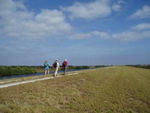
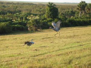
A former cattle ranch, Three Lakes Wildlife Management Area (which includes the Prairie Lakes Unit) is a wetland restoration project, bringing the hydrology of the region back to what it was before Hamilton Disston started his first drainage projects around Lake Kissimmee in 1910 to open up new agricultural lands. The wet prairies around Lake Kissimmee provide crucial wintering grounds for both sandhill cranes and whooping cranes. The trail passes through palmetto prairies, pine flatwoods and open scrubPassing under Florida’s Turnpike in Three Lakes WMA (Deb Blick). In the rainy season, you will wade in many places.
From its northern trailhead, the Three Lakes section makes a good weekend outing, as it has several loop trail options. The through-trail follows the west side of the South Loop and the east side of the North Loop, through half of a figure-8 configuration. Each trail junction has good signage, necessary to avoid confusion. The trail in Three Lakes Wildlife Management Area consists of two loop trails and two linear trails connecting the loops to the north end and the south end of the WMA. The two loop trails, North Loop (5.6 miles) and South Loop (5.6 miles), are within the Prairie Lakes Unit.
The Three Lakes Trail wanders through marsh, meadow, hammock, and pine forest. As in all Wildlife Management Areas, there is an abundance of animals. Deer are plentiful. Hikers may also see bald eagles, Audubon’s caracara, and the stately sandhill crane.
 Length: 37.7 miles (linear)
The thru trail follows the west side of Bull Creek along the old railroad grade. Ties and hardware remain along the route. Pines in the northeast corner of the property still have “catfaces” (areas on trees where iron gutters were attached to harvest the pitch). Additional trailside history includes a small cemetery in Bull Creek, flow wells, and the remains of a turpentine still and sawmill. Today, the property is managed jointly by St. Johns River Water Management District and the Florida Fish and Wildlife Conservation Commission for flood water retention, wildlife management, and public recreational use.
At the south end the trail passes through the Allen Broussard Conservancy a private nature conservancy. Hikers have the opportunity of viewing sandhill cranes and wood storks along with cattle. A campsite on the property offers a rare shower. Further north, the trail passes through the Bull Creek Wildlife Management Area. In the past, this area was used for grazing, timbering, and the production of naval stores. A system of rail and tram roads for logging was established during the early 20th century.
 Length: 20.8 miles (linear)
Leaving Starvation Slough, you enter Kissimee Prairie Preserve State Park. This park was recognized in 2016 as Florida’s first Dark Sky location with incredible stargazing options. This region also hosts the largest remaining section of dry prairie in Florida. Wildlife is abundant in these preserved habitats In this area, you can see crested caracaras and Florida grasshopper sparrows. Florida grasshopper sparrows are one of the rarest birds in North America as so much of their habitat has been eliminated. A primitive campsite is available in the park and requires a reservation. Prepare for a very exposed hike through this section. A pitcher pump is available at the Cowboy Crossing campsite.
 Leaving KPPSP, you will enter the land that was once known as the Kissimmee Island Cattle Company (now called KICCO-pronounced Kiss-Oh). The Consolidated Naval Stores Company purchased this land and planned to add it to their thousands of acres in the state and create a cattle ranch with accommodations for the residents and visitors. Homes were quickly built for the 52 workers at Camp Hammock who in turn built the town along the Kissimmee River. The post office, general store, meeting and dance halls, post office, power plant and homes were spread along the bank complete with paved sidewalks, electricity and manicured lawns. Steamboats from Okeechobee regularly brought supplies to the residents. Though a paradise looking in, the town was doomed from the beginning. The flu epidemic of 1918, ticks on the cattle and the costs associated with the town led to demise just a few years later. In 1929, a rebranded “Horseshoe Ranch Fishing and Hunting Club” was opened but lasted only one year due to the Great Depression reaching Florida. South Florida Water Management District purchased the land in 1983. Today, all that can be seen of the original town are the sidewalks beside the river, a quiet remnant of what was.
Hikers in this area will pass through oak hammocks and open cattle fields with KICCO. Be sure to leave all gates as you find them and be on the lookout for cattle. Part of the trail is very exposed so plan accordingly.
") Length: 33.2 miles (linear)
Length: 33.2 miles (linear)
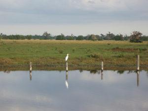
Heading north from Lake Okeechobee, you will enter the Kissimmee River region. All along this segment, the trail parallels the Kissimmee River, which recently underwent restoration to its former meandering path. Water levels in the area have changed as a result and many sections of this region may be wet often. However, the beauty found in this region is unique. Sweeping views of the rivers give way to large oak hammocks including the famous Starvation Slough Cathedral. Passing alongside many cattle ranches, one can see true old Florida in its pristine state.
Permits must be obtained from the South Florida Water Management District to camp in Chandler Slough, Micco Landing, Yates Marsh, Oak Creek and Starvation Slough. Permits can be obtained at www.sfwmd.gov/community-residents/recreation/sul .
 Length: 33.1 miles (linear)
Enjoy scenic views of the lake and adjacent agricultural lands from the Herbert Hoover Dike. Trailer parks, campgrounds, and other businesses catering to tourists are also visible from the trail. The dike, together with the pumping station and navigational lock at Taylor Creek, are examples of the extensive flood control works that have been constructed to protect the surrounding lands and development.
Most of this segment of the trail is located on dikes along the east side of the Kissimmee River and Lake Okeechobee. Sandhill cranes and a variety of wading birds can often be seen feeding in pastures to the east of the levee along the river. There is a grove of Indian rosewood trees along this stretch of trail. Structure S-65E represents one of six lock and spillway structures constructed along the Kissimmee River in the 1960’s (several are scheduled for removal as part of the Kissimmee River Restoration Project). Hikers passing by are sometimes able to watch boats being locked through the structure.
 Length: 40.5 miles (linear)
This section of the Florida Trail follows the Herbert Hoover Dike and a three mile stretch of SR 78, (across Fisheating Creek floodplain) near Fish Eating Creek WMA around the northwest side of Lake Okeechobee. This is the most remote and scenic stretch of the levee, where views of the lake yield to views across expansive marshes like the palmetto-dotted Indian Prairie. Views away from the lake include sugar cane fields stretching to the horizon, and scenic cattle ranches with prairies, palm hammocks and remnants of the original lakeshore.
The marshlands and trees attract an abundance of wildlife. Birders on the Great Florida Birding Trail will especially enjoy this section of the Florida Trail for the number of species that can be spotted, including meadowlarks racing along the dike, flocks of sandhill cranes gathering on the prairies within the cattle ranches, and wading birds such as egrets, herons, and wood storks. White pelicans have been spotted here, as well as swallow-tailed kites. Small mammals seen along the marsh edge include nutria, otters, and raccoons.
Hikers pass several navigational locks and pumping stations that are features of the flood control works protecting the lands around the lake. One of the more unusual man-made features is known as the “Hiker’s Graveyard,” a collection of granite slabs driven into the dike to add stability.
Fisheating Creek is the only waterway that retains its natural flow into Lake Okeechobee, so there are several miles where there is no dike along the creek’s floodplain. Hikers must follow the berm of SR 78 to resume walking atop the dike.
Much of the Lake Okeechobee trail is closed for renovation of large sections of the Herbert Hoover Dike. Please refer to our Trail Closures and Notices webpage for updates and reroutes.
 Length: 22.3 miles (linear)
Lake Okeechobee is one of the largest freshwater lakes in the United States, encompassing an area greater than 730 square miles. Only Lake Michigan is larger. It is a fisherman’s paradise and is easily accessible by both water and land.
This segment of the FNST follows the Herbert Hoover Dike along the east side of Lake Okeechobee. A major landmark encountered by hikers on this section is the Port Mayaca Lock and Dam, one of five lock and dams on the cross-state Okeechobee Waterway which extends from Stuart on the east coast to Ft. Myers on the west coast. It runs through the lake and accommodates commercial vessels, fishing boats, and pleasure craft.
Hikers along this section of the trail might want to consider a side trip to the nearby DuPuis Reserve which is south of the St. Lucie Canal about two and a half miles east of Port Mayaca. The reserve boasts excellent wildlife viewing opportunities and has an extensive system of trails available to day hikers and backpackers. Plans are in the works to connect the Florida Trail around Lake Okeechobee to DuPuis Reserve as part of the Ocean-to-Lake Trail.
Much of the Lake Okeechobee trail is closed for renovation of large sections of the Herbert Hoover Dike. Please refer to our Trail Closures and Notices webpage for updates and reroutes.
 Length: 31.3 miles (linear)
Welcome to South Florida as envisioned by entrepreneur Hamilton Disston and Florida governor Napoleon Bonaparte Broward at the turn of the last century, the “useless swamplands” of the upper Everglades drained to reveal the rich “black gold” beneath the sawgrass, a nutrient-rich muck ideal for agriculture. Sliced and diced by canals, what were once the Everglades is now a patchwork of cattle ranches, muck farms, and the nation’s largest sugar cane holdings.
From the beginning to the end of this segment, the trail follows levees managed by the South Florida Water Management District, paralleling the canals. Shade is at a premium, usually found as a brief respite under a rare tree or in the shadow of a water control structure. Blazing is sporadic but there are Florida Trail shields to guide the way in many areas. The open nature of the hike allows you panoramic views of agriculture in action, especially the fascinating process of a sugar cane harvest. Expect to make good time on these easily traversed dikes.
Camping is permitted in two designated campsites only. Both STA 5/6 and the L1-E campsites require a free permit from South Florida Water Management which can be obtained here. Although water is available all along the route from the trailside canals, it can be of dubious quality thanks to agricultural runoff; filter before boiling.
After the levees, you will reach Lake Okeechobee, one of the largest freshwater lakes in the United States, encompassing an area greater than 730 square miles. It is a fisherman’s paradise and is easily accessible by both water and land. The cross-state Okeechobee Waterway crosses the lake and accommodates commercial vessels, fishing boats, and pleasure craft.
Hikers heading north from Big Cypress Preserve have the choice of walking around the east or west sides of Lake Okeechobee once they reach the intersection of US 27 and the Miami Canal. Portions of this section are managed by the U.S. Army Corps of Engineers and the South Florida Water Management District.
Scenic views of the lake and the adjacent agricultural lands are afforded from the levee. Major recreation areas are accessible from the trail at Clewiston, Lake Harbor, South Bay, Pahokee and on Torrey Island west of Belle Glade. Hikers will also pass several major pumping stations and a navigational lock. These facilities are among a number of similar structures located around the lake which, together with the Herbert Hoover Dike, comprise the extensive flood control works that have been constructed to protect the adjacent lands and communities.
The trail around Lake Okeechobee reopened fully in 2023 after years of construction. Hikers can now fully enjoy the trail without any closures!
 Length: 40.3 miles (linear)
The trail north of Big Cypress National Preserve lies within the Big Cypress Seminole Indian Reservation. Much of the landscape is similar to the Preserve, except it gets somewhat higher and drier with more pinelands. Hikers view canals, orange groves, farm and cattle lands, and Indian homes including their picturesque chickees.
 Length:8 miles (linear)
 Length: 24.6 miles (linear)
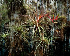
The Florida Trail’s Southern Terminus is located here at the Oasis Visitor’s Center in Big Cypress National Preserve which encompasses 729,000 acres of subtropical terrain, about a third of which is covered with the dwarf pond cypress. Bordering the northern edge of Everglades National Park. Big Cypress is named for its great expanse, not the size of the trees. In addition to the cypress swamp, the landscape has sandy islands of slash pine and hardwood hammocks, as well as sloughs, wet prairies, marshes and mangrove thickets.
This section of the Florida Trail passes through the great swamp of dwarf pond cypress and crosses pine islands, hammocks, giant ferns, and prairies with cabbage palm and saw palmetto. Bromeliads (air plants) are everywhere. Seven Mile Camp is a particularly interesting location, where the night sounds of the chuck-will’s-widows mingle with the occasional screams of a bobcat or the sound of wild turkeys. Bluebirds, quail, kites, wood storks, short-tailed hawks, and the endangered red-cockaded woodpecker may also be seen.
Big Cypress is also home to eagles, deer, alligators, the Florida Black Bear, feral hogs, and the Florida panther. Alligator holes can sometimes be detected in drier weather when the water level is down.